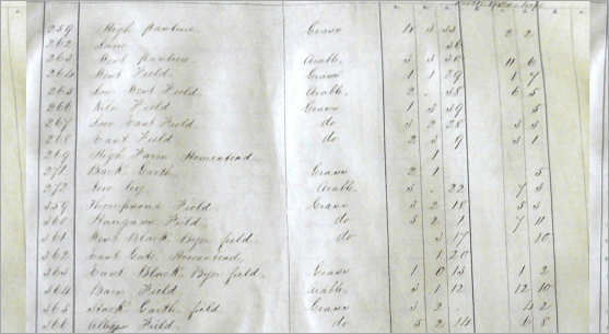
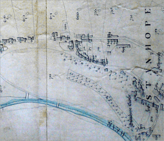
The Tithe Apportionment of 1842 indicates who owned and occupied each plot of land (field, allotment, farm or house). Being so close in date to the 1841 census, it can be used to complement the latter source, and to more accurately locate a particular family. The images to the right are digitised sections of the map and apportionment for the Town Quarter of Stanhope Parish.
The actual tithe maps and apportionment registers can be viewed in The Record Office in Durham.
Our Tithe Records consist of :
- Digitised tithe maps images of Stanhope Parish.
- Digitised tithe map images of Wolsingham Parish;
- Transcriptions of Apportionments (in fully searchable spreadsheet format) of the Forest and Park Quarters of Stanhope Parish;
- Images of the apportionments for Stanhope Town & Newlandside Quarters and Wolsingham Parish.